The Portofino regional park is a protected area of around 1,250 hectares covering the headland of the same name, a puddingstone formation (sedimentary conglomerate) that drops sheer into the Ligurian Sea between Camogli, Santa Margherita Ligure and Portofino. Its distinctive feature is the coexistence of two very different environments within a short distance of each other: the southern slope, exposed to the south and covered in Mediterranean scrub, and the northern slope, cooler, where holm oaks, sweet chestnuts and species typical of more humid climates grow. The contrast is noticeable as soon as you start walking.
The area is managed by the Ente Parco Naturale Regionale di Portofino, which publishes regulations, maps and notices on path closures on its official site. Management of the marine stretch is entrusted instead to the Portofino Marine Protected Area (AMP), which operates with its own regulations and three differentiated protection zones: for updates we recommend consulting the AMP site.
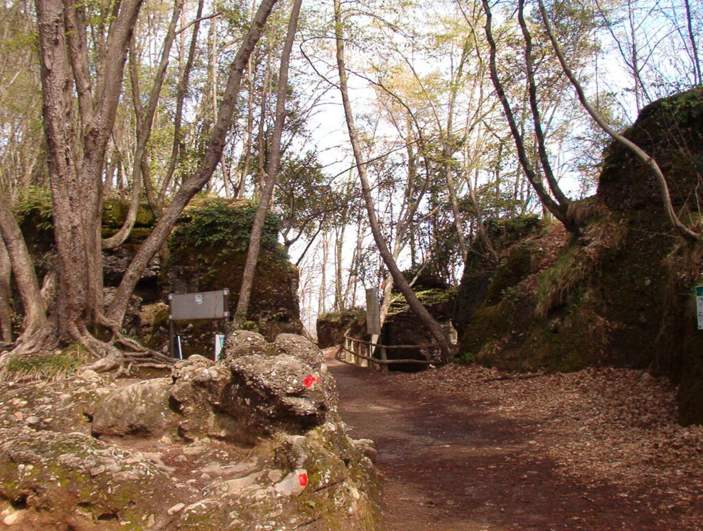
The paths: 13 km of official network
The official path network of the park totals around 60 kilometres, with a core of 13 kilometres of main routes well marked with the geometric symbols (circle, square, triangle, cross) of the Ligurian walking tradition. The most-walked routes:
- Portofino Mare – San Fruttuoso (“Base 0” path): the classic coastal route, around 2 hours of walking with moderate elevation gain and some exposed sections. Constant sea view, vegetation of pines and holm oak.
- Portofino Vetta – Pietre Strette – San Fruttuoso: a longer route (3-4 hours in total) but also more varied, passing through the highest point of the headland.
- Ruta di Camogli – Portofino Vetta – Olmi – Pietre Strette – San Fruttuoso: the full traverse, reserved for fit walkers (5-6 hours).
- Pietre Strette – Batterie: a short panoramic loop on the former military emplacements, with views over the southern side of the headland.
- Santa Margherita Ligure – Nozarego – Olmi: an entry from the east, convenient for those staying in Santa Margherita.
The difficulties are not technical but should be taken seriously: the paths are often stony, slippery after rain, and in some sections (particularly the coastal route to San Fruttuoso) require care for the changes in elevation and the stone steps. For technical details on the routes we refer to the official page on the paths of the Park of Portofino; check the current schedule and any closures before setting off.
Flora: the Mediterranean scrub that endures
The southern slope of the headland is dominated by Mediterranean scrub: Aleppo pine (Pinus halepensis), holm oak (Quercus ilex), strawberry tree, myrtle, broom, mastic, rockrose, tree spurge. In spring the rockrose and wild orchids are in flower, in autumn the fruits of the strawberry tree and myrtle ripen. On the cooler, damper northern slope, sweet chestnut, hop hornbeam and species typical of Apennine woodland appear.
The park is a Site of Community Importance in the Natura 2000 network precisely because of the floristic richness of the headland. Endemic and rare species are present, such as Campanula sabatia, and several wild orchids of the genus Ophrys.
Fauna
Terrestrial fauna includes wild boar (visible mainly at dawn or dusk), foxes, badgers, squirrels, hedgehogs and a population of raptors that includes sparrowhawks, kestrels and common buzzards. Along the marine stretch and on the cliffs, yellow-legged gulls, cormorants and the rare Audouin’s gull nest. Among the smaller vertebrates, geckos and several non-venomous snakes of the colubrid family.
Marine Reserve: the AMP
The Portofino AMP, established in 1999, extends for around 18 kilometres of coastline from Camogli to Portofino-Faro as far as Sestri Levante (external protection zone). It is organised into three zones:
- Zone A (integral reserve): a small sector at Cala dell’Oro where swimming, fishing and anchoring are forbidden.
- Zone B (general reserve): diving permitted, anchoring on marked buoys, fishing allowed only for residents under specific rules.
- Zone C (partial reserve): the widest, where swimming is free but leisure boating is regulated.
The AMP is also one of the best-known Italian sites for scuba diving, with points such as the Secca dell’Isuela, the Dragone, the Christ of the Abyss in front of the San Fruttuoso abbey and several wrecks. Access is regulated: to dive you need authorisation through an approved diving centre.
Geology and landscape
The geological feature of the Portofino regional park is the puddingstone, a sedimentary conglomerate of Eocene age made up of rounded pebbles cemented in a sandy matrix. This very hard material has allowed the headland to resist marine erosion where the surrounding rocks (limestones and marls) have been shaped differently, creating the cliffed relief typical of the southern slope. The puddingstone is visible in several places, particularly along the coastal path to San Fruttuoso and in the coves at the foot of the lighthouse.
This geological characteristic also explains the layout of the paths: the routes often follow vegetation bands that correspond to different exposures of the puddingstone to sun and wind. Freshwater springs are limited, and this influences the flora: Mediterranean scrub dominates where the soil is thin, while holm oak woodland grows in the damper inner valleys.
When to go
The paths on the headland are walkable all year but have ideal moments. April and May for the scrub in flower. October and November for the autumn colours on the northern slope and mild temperatures. Summer is walkable but the southern slope offers little shelter: set out early in the morning, carry at least 1.5 litres of water per person and a hat. The choice of time of day matters considerably. Avoid the days after heavy rain, when the stony paths become very slippery.
Access and rules
The Portofino regional park has no entry ticket and the paths are freely accessible. Some essential rules are in force, however:
- Dogs on a lead on all paths.
- No lighting of fires and no camping.
- No collection of protected flora (orchids, strawberry tree fruit for commercial purposes, etc.).
- Mountain bikes allowed only on certain specifically indicated paths: check the official map.
The most convenient access is from Portofino village (see how to get there), from Ruta di Camogli or from Santa Margherita Ligure. For further detail see also the entry Portofino Park on the English Wikipedia.
Equipment and safety
For anyone tackling a walk in the Portofino regional park we recommend basic equipment and attention to a few practical points:
- Trekking shoes with a moulded sole or, alternatively, robust approach shoes. Smooth soles on water-washed rock become dangerous.
- At least 1.5 litres of water per person in summer, 1 litre in other seasons. There are no fountains along the paths.
- Hat, sunglasses, high-protection sun cream: the southern slope does not offer continuous shade.
- Charged phone and offline-map app (Komoot, AllTrails, GAIA GPS). Phone signal is intermittent in the inner valleys.
- Emergency number 112 (NUE). For alpine and sea rescue, the Soccorso Alpino Speleologico Ligure is activated through 112.
- Leave no rubbish: the protected area has no bins along the paths, and carrying out your own waste is an implicit rule.
What to do in case of rain
If the weather worsens, some paths in this part of Liguria become slippery or frankly dangerous (particularly the coastal route between Portofino and San Fruttuoso, with its stone steps). In case of rain we recommend postponing the walk and switching to indoor activities: Castello Brown, a visit to San Fruttuoso abbey by ferry (check that the service is not suspended), or an afternoon in central Genoa for the Palazzo Ducale or the Aquarium.